Happy Friday! The wind has been around for a few days already up ahead of our nor’easter, and gusts will only continue to gain strength into Saturday and Sunday morning. The rain will take a bit longer to get here outside of the Cape and islands.
The evening commute will be dry outside of southeastern Massachusetts, but later this evening and tonight we’ll finally see some spotty light showers even potentially north of the Mass Pike as the nor’easter advances from the south.
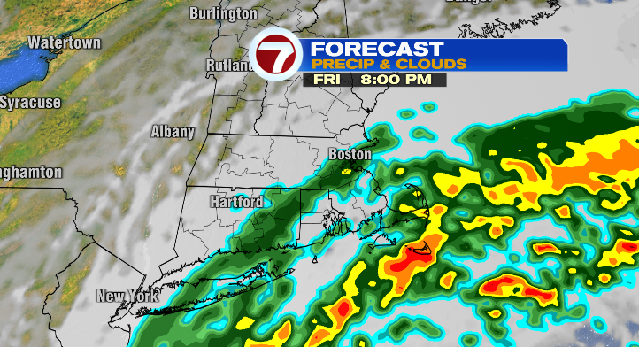
The rain will continue to push in overnight into Saturday morning.
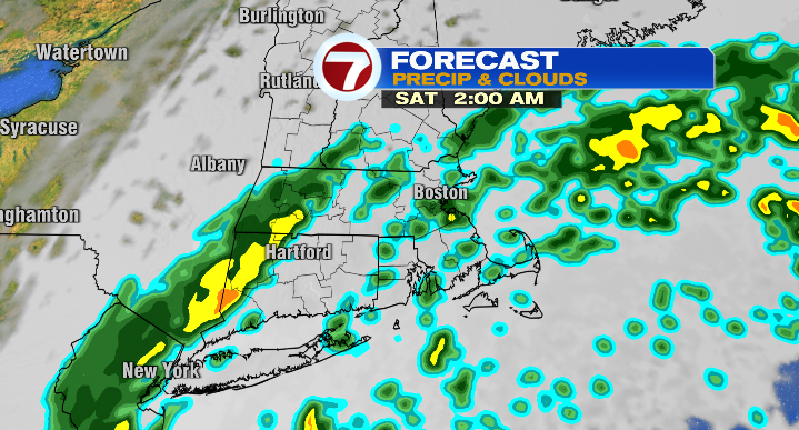
Much of the rain will still be light to moderate at that time.
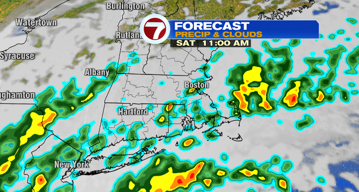
That changes Saturday afternoon and especially evening as the rain becomes more robust. Rain will become more widespread and heavier.
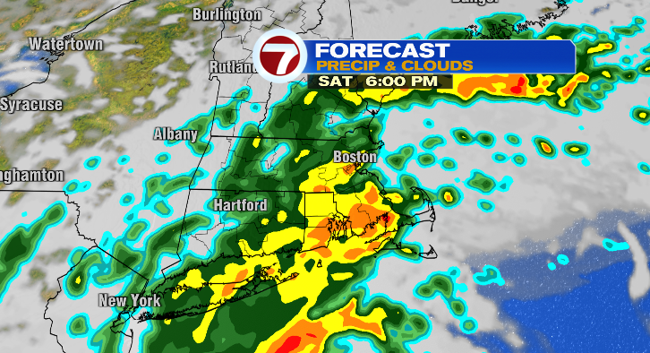
Don’t forget the wind will be blowing at that time, so a driving rain will reduce visibility on the roads. If that makes you uncomfortable, I wouldn’t get behind the wheel. Remember, this is a slow-moving storm system. This will be a long duration event, so the rain will continue into Sunday. Expect wave after wave after wave of rain with pockets of moderate to heavy rainfall and a risk of water pooling on the roads. Take it slow.
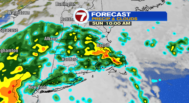
The rain will linger all the way into the day on Monday.
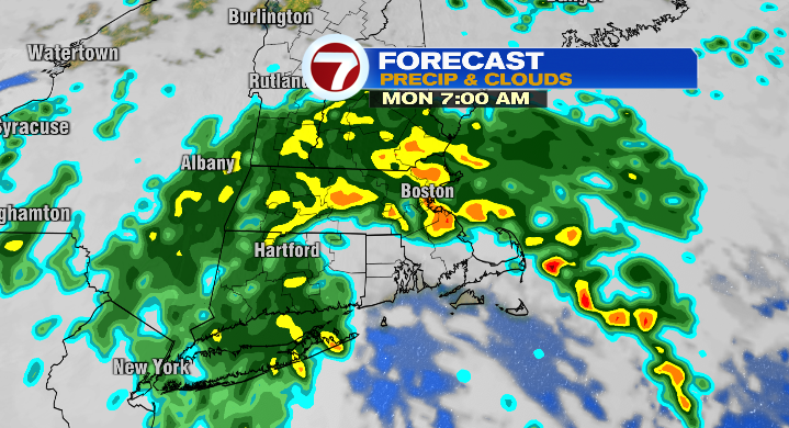
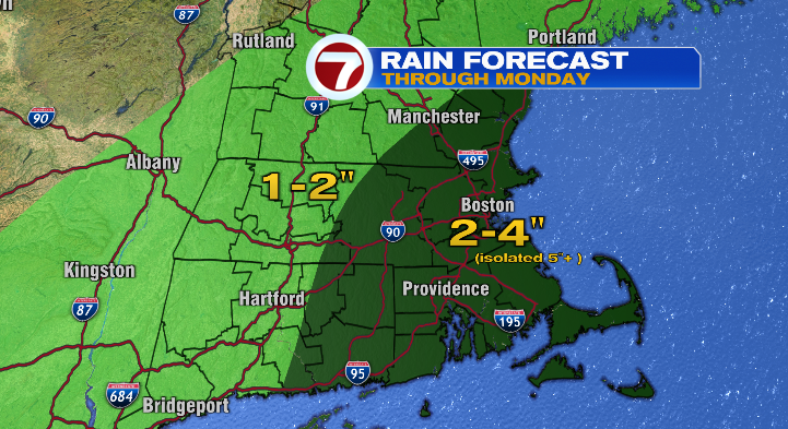
By the time all is said and one, most will pick up 2-4 inches, but there may be isolated spots of up to 5-6 inches where downpours persist. Overall, the flash flood risk is not the greatest threat from this storm.
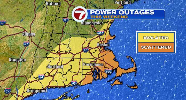
The wind will be the greatest threat from our fall nor’easter that affects most of us. It’s been windy for days already due to high pressure from our north and the advancing nor’easter creating a squeezing affect in the atmosphere. You can think of it like wind tunnels between high rises in downtown Boston: where the air is squeezed it must speed up. That being said, the peak gusts will occur Saturday into Sunday morning. From Cape Ann through Boston, near and east of route 3 in Plymouth County and on the Cape and islands is where the gusts will be the strongest from 45-55 mph and that’s where our greatest risk of power outages is.
Temperatures will stay in the 50s and 60s throughout the event, so at least we’re not overly concerned with losing heat like we would during a wintertime nor’easter.
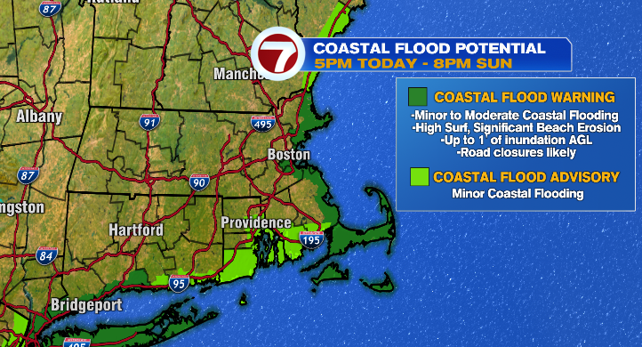
Our coastal flood warning goes into effect at 5 p.m. today and continues through Sunday evening, that’s for up to a foot of inundation above ground level. Impacts include widespread flooding of vulnerable areas near the waterfront and shoreline, including roads, parking lots, parks, lawns, and homes and businesses with basements near the waterfront, according to the National Weather Service. Numerous road closures are likely, and vehicles parked in vulnerable areas near the waterfront will likely become flooded. Flooding will also extend inland from the waterfront along tidal rivers and bays.
Monday the showers and the breezy conditions continue, but to a much lower extent than the weekend. Temperatures will still be cool in the 50s and 60s.
Tuesday will be mostly cloudy but drier with just a low-end chance for a spot shower. We’ll warm from lows in the 50s to highs in the upper 60s. Wednesday looks partly sunny and warmer in the low 70s. Both Thursday and Friday will feature partial sun and warmer highs in the mid to upper 70s. Something to look forward to after our nor’easter. Stay tuned for updates!
from Boston News, Weather, Sports | WHDH 7News
Source: https://ift.tt/uLBczE7
Comments
Post a Comment