Happy Tuesday! It’s a warm one out there now, but it’s nothing compared to what we’re expecting starting Wednesday.
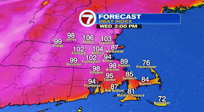
First, we can’t rule out a passing shower or thunderstorm this evening or overnight. Otherwise, temperatures will be cooling from the 80s to the 70s this evening with overnight lows only bottoming out in the upper 60s and low 70s. That means our jumping off point for the extreme heat Wednesday is already high, allowing the ample sunshine to warm us all the way into the upper 90s. However, with dew points climbing into the 70s, that’ll feel more like the low 100s.
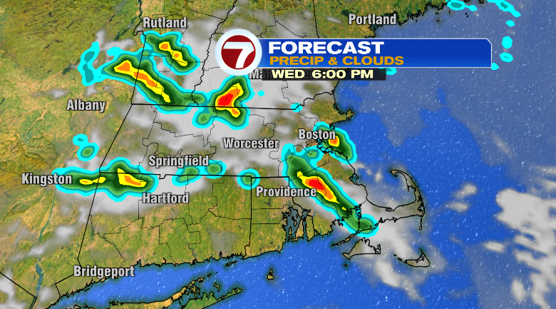
There’s also a chance for some spotty evening and night storms Wednesday.
Thursday the extreme heat continues, and this day will likely be the peak. Highs are forecast to jump to the low 100s after waking up to temperatures already warm in the mid 70s. With humidity still extremely high, that will create heat index values up to 112 degrees. That’s dangerous-type heat you’ll need to prepare for. Thursday looks mostly sunny as well.
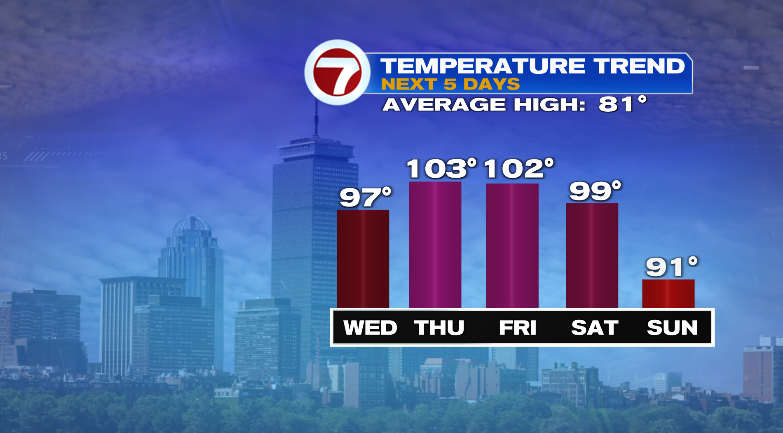
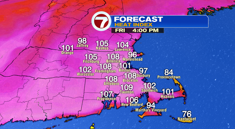
Friday won’t be far off. We start the day very warm in the upper 70s with mostly sunny skies jumping us to 102 degrees. The humidity won’t break just yet.
The Fourth of July is Saturday! It’ll still be incredibly hot and humid. The day starts off in the mid 70s with highs in the upper 90s. Heat index values will still be over 100 degrees. Skies will be partly sunny, and we cannot rule out some scattered afternoon and evening thunderstorms.

A spot storm is possible Sunday as highs cool to the low 90s. The relief comes Monday. Highs drop to the mid to upper 80s with noticeably lower humidity. Tuesday looks nice, partly sunny with highs in the mid 80s. Stay tuned!
from Boston News, Weather, Sports | WHDH 7News
Source: https://ift.tt/BHs3Dze
Comments
Post a Comment