Happy Monday! Tuesday morning will be the last frigid, arctic-like morning we’ll have this week before a nice warm-up. However, we’ve got some snow on the way too.
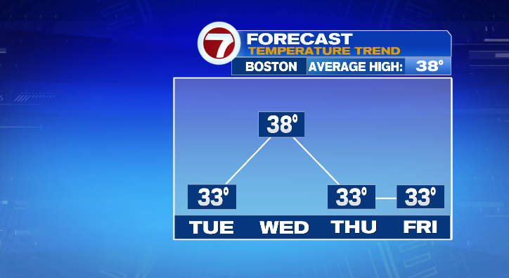
The rest of your Monday evening will be mainly clear with temperatures dropping back into the teens. Overnight lows will get down to the single digits once again. Tuesday starts bright and frigid cold, but clouds will be on the rise along with a warm-up to the low 30s in the afternoon.
Skies will be dry into the early afternoon, but snow rolls in between 5 and 7 p.m.

The snow consistency will be wetter but the snowfall rate will be rather light. Snow shower chances linger as late as 12-2 a.m. along the coast.
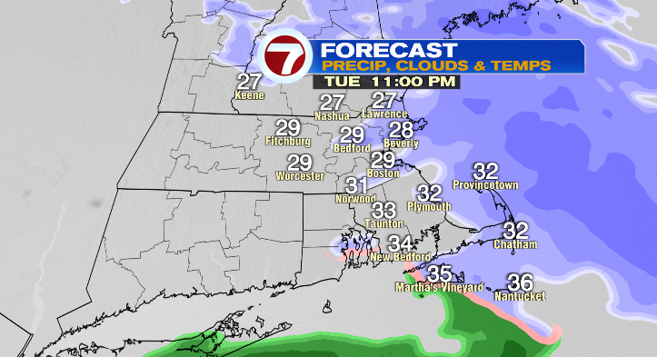
There may be some mixing or rain on the islands and the Cape at times late Tuesday night. For the rest of us, it will remain as plain snow.

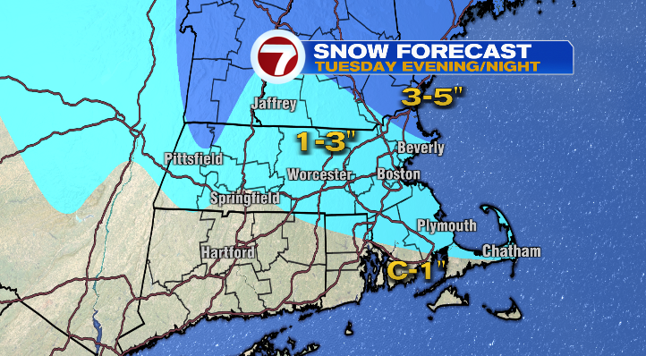
Overnight lows into Wednesday morning will get down to the mid 20s. By the time we wake up Wednesday morning, most of us will have between 1 to 3 inches of snow on the ground.
The rest of Wednesday we warm even more to the upper 30s under mostly cloudy skies. Thursday: 20 to the low 30s with partly sunny skies. Friday, still not bad! Partly sunny, colder to start in the teens but making it into the low 30s again in the afternoon.
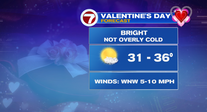
Valentine’s Day looks nice! Cold in the teens in the morning but low 30s in the afternoon with partly sunny skies and at the very most a few random flakes.
Sunday starts in the teens but in the afternoon we’ll only be a few degrees shy of the 40-degree mark! It’ll be bright again but we’re tracking our next chance for some wintry weather Sunday night into Monday. Stay tuned!
from Boston News, Weather, Sports | WHDH 7News
Source: https://ift.tt/9VeJGRU
Comments
Post a Comment