Buckle up! We’re in for a very active weather pattern this weekend with snow for Saturday before dangerous wind chills roll in Saturday night into Sunday.
First, for the rest of your Friday, there may be some flurries around at points. Isolated light snow is possible, however the real, accumulating, snow will push in after midnight. It will be snowing most of the day Saturday before settling down in the evening.
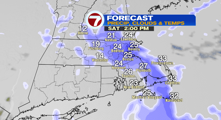
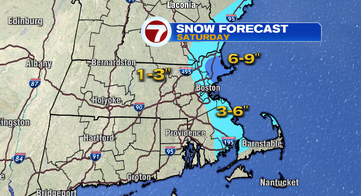
By the time the snow wraps up Saturday evening, eastern Massachusetts will pick up 3-6 inches of snow, with a higher pocket of snow expected in northeastern Massachusetts.
After the snow comes one of our coldest Arctic blasts so far this winter. Temperatures will dive from the 20s down to the teens in the evening with overnight lows into Sunday morning tumbling to near zero.
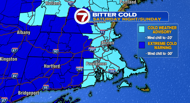
The bigger problem is the wind that will increase Saturday night, bringing our wind chills into the negative teens and negative 20s into Sunday morning.
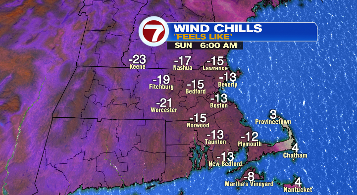
Sunday we won’t make it out of the teens, but with the winds gusting to near 30 mph, it’ll only feel like the single digits during the warmest part of the day. Bundle up!
Monday we start in the single digits with highs in the low 20s under partly sunny skies. Tuesday, teens to near 30 which is a warm-up! Wednesday and Thursday will feel much better with morning temperatures in the teens and 20s with afternoon highs into the low to mid 30s. However, we’re watching a chance for snow those days. We dry back out for Friday. Stay tuned!
from Boston News, Weather, Sports | WHDH 7News
Source: https://ift.tt/pQm8wfI
Comments
Post a Comment