Happy Sunday! It was noticeably colder today, but temperatures will start rebounding nicely this week. However, that does come with some chances for rain and snow.
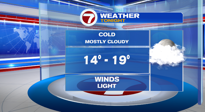
The rest of your evening will cool down quickly to the 20s and teens. Overnight lows will drop to the mid to upper teens under mostly cloudy skies.
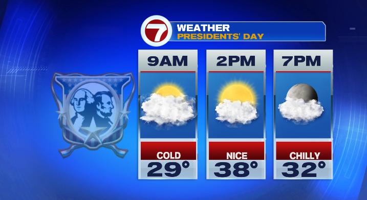
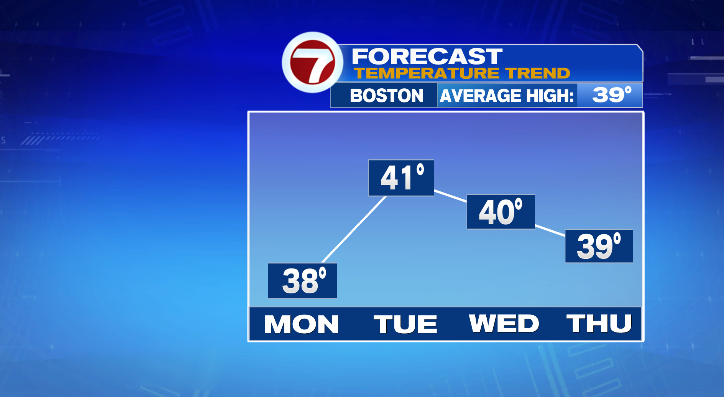
Monday starts a bit cloudy but sun will build a bit as the day goes on.
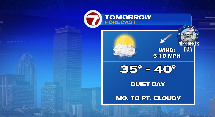
While the morning will be cold, highs in the afternoon will be closer to average in the mid to upper 30s.
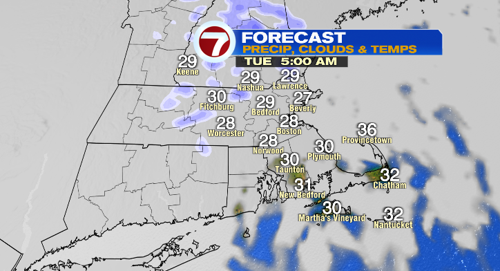
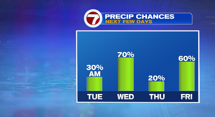
We’ll still be a miss for the snow. At the very most I’d say an isolated snow shower is possible over the islands or the south shore, but that chance continues to dwindle. Tuesday morning there’s a chance for an isolated light snow shower early in the morning. The day starts cloudy with a little sun in the afternoon. Highs will be mild in the low 40s after a morning in the 20s.
The really unsettled weather pattern begins Wednesday. We have chances for both rain and snow that day with lows in the upper 20s and highs near 40 degrees.
Thursday looks mainly dry with highs in the upper 30s.
The active pattern ramps right back up with chances for rain and snow on Friday with highs near 40 degrees again. That chance lingers into Saturday with another snow chance for Sunday. Stay tuned!
from Boston News, Weather, Sports | WHDH 7News
Source: https://ift.tt/mnXPdBy
Comments
Post a Comment