We’ll finally see some much drier weather over the next few days in Massachusetts, however our breezy conditions will continue.
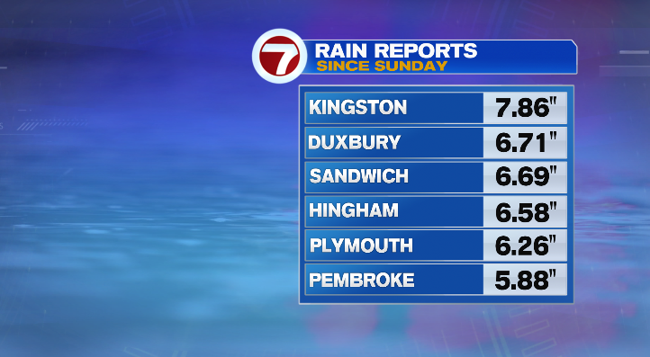
First, some areas across southeastern Massachusetts picked up over 5-7 inches of rainfall from our nor’easter!
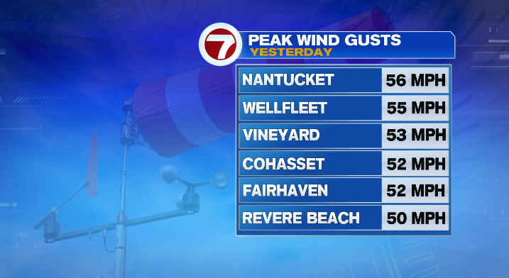
Thankfully the sandier soil there allows water to drain quickly, so flash flooding wasn’t an issue. Winds inland weren’t too significant, overall 30 to 40 mph. Yet on the coast, many spots saw gusts top 50 mph.
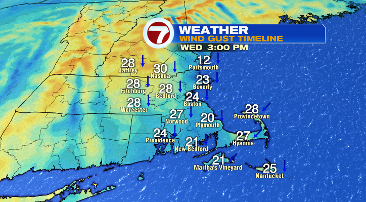
While we’re set to dry out over the next few days, the breeze will continue. For Wednesday, morning lows will drop to the 40s with highs reaching the upper 50s and low 60s. Skies will be partly to mostly cloudy, but free of rain! Winds will still occasionally gust to over 20 mph.
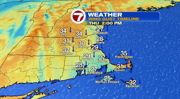
Thursday will remain dry except for a spot shower on the Cape. Morning lows will be cold though! They’ll drop down to the 30s with afternoon highs only in the low to mid 50s. The breezy conditions may make it feel a bit brisk.
Friday will still be breezy but brighter with morning lows cold in the 30s with afternoon highs in the upper 50s and low 60s.
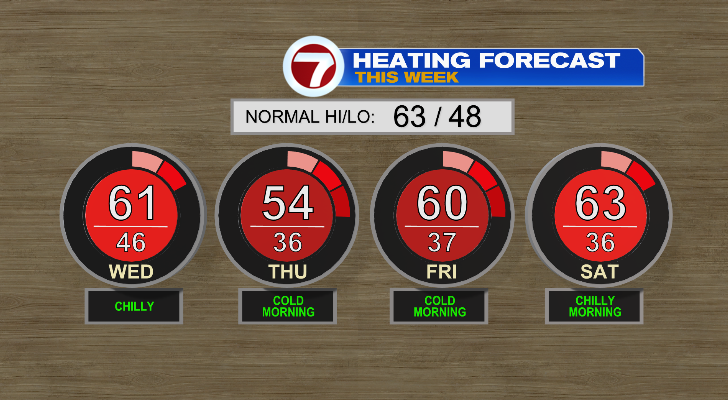
Saturday morning will again start in the 30s! Your heat will be needed to keep warm during those few mornings. Saturday afternoon, though, we’ll be back in the low 60s with brighter skies. Sunday will reach nearly 70 degrees after a less cold morning in the 40s.
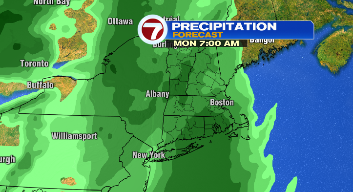
We’re tracking our next round of rain Sunday night into Monday.
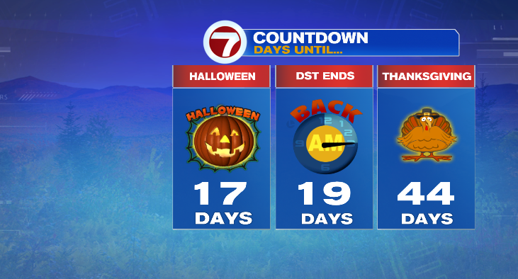
As if the cold mornings weren’t a strong enough signal that we’re getting farther into the autumn season, we aren’t far off from Halloween and also the end of Daylight Saving Time!
Stay tuned!
from Boston News, Weather, Sports | WHDH 7News
Source: https://ift.tt/9ohpIX7
Comments
Post a Comment