Get ready for some ups and downs this week!
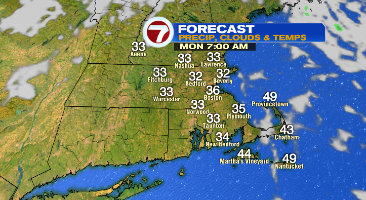
First, clear skies overnight will allow for a strong cooldown early Monday morning as you’re headed out the door to work. Low temperatures will get down to the low 30s!
Skies will be partly cloudy, and we can’t rule out an isolated sprinkle mainly across eastern Massachusetts — that’s about it. Afternoon highs will top off in the low 50s.

Tuesday morning will be another cold one! Lows will drop to the mid 30s. Skies will be cloudier, and we again can’t rule out a spot light shower on the coast.
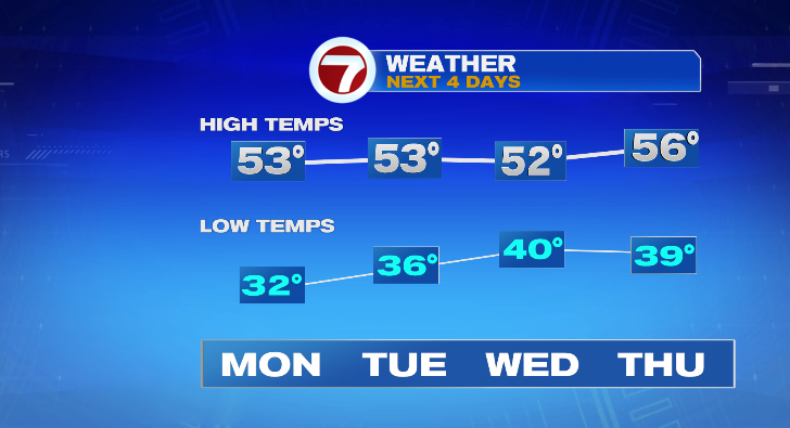
Wednesday morning will be more normal for this time of year in the upper 30s and low 40s. Skies will feature more clouds than sun with highs in the low 50s. There could be some isolated light showers across our area.
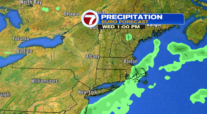
We are tracking our next potential storm system for late this week.
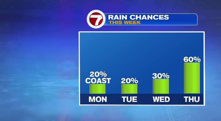
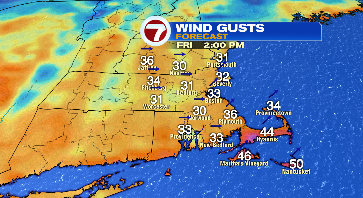
Most forecast models bring in the rain and wind Thursday, but it’s the exit time that’s still up in the air. Thursday highs will reach the mid 50s after morning lows in the upper 30s. In terms of the rain, some forecast models show it exists early Friday morning, some show the storm lingering longer. With Friday being Halloween, this is something we’ll watch closely this week!
We will have some strong wind gusts with the rain, near 30-40 mph, but this is something that we’ll have to watch closely this week as well. Regardless of when the rain exits, Friday’s morning low will be in the mid 40s with afternoon highs in the upper 50s.
We are looking drier for next weekend. Stay tuned!
from Boston News, Weather, Sports | WHDH 7News
Source: https://ift.tt/SHnqIlN
Comments
Post a Comment