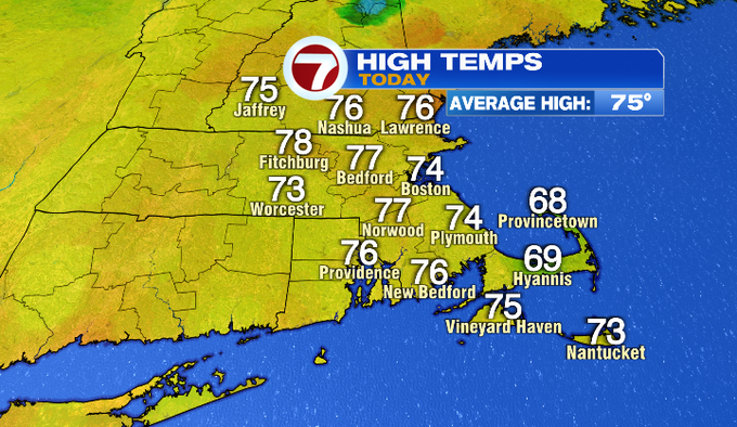
Lovely weather for us today! After a cool morning, highs rebounded to the upper 70s inland. It will be a pleasant end to our work week and start of our weekend.
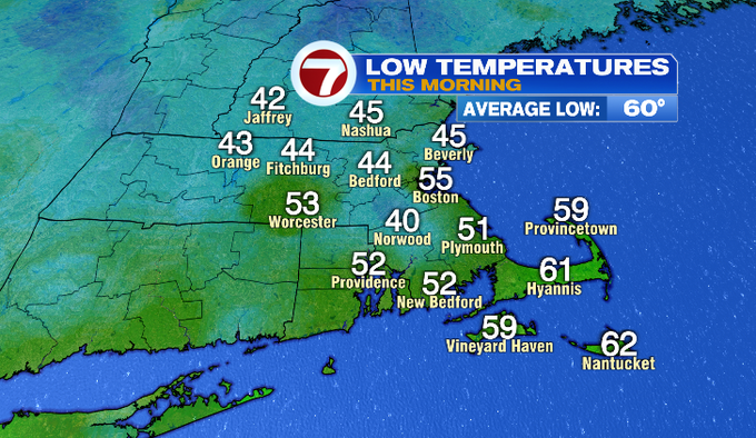
Here were are our morning low temperatures. It will be another cool night with most of us falling into the 40s and 50s.
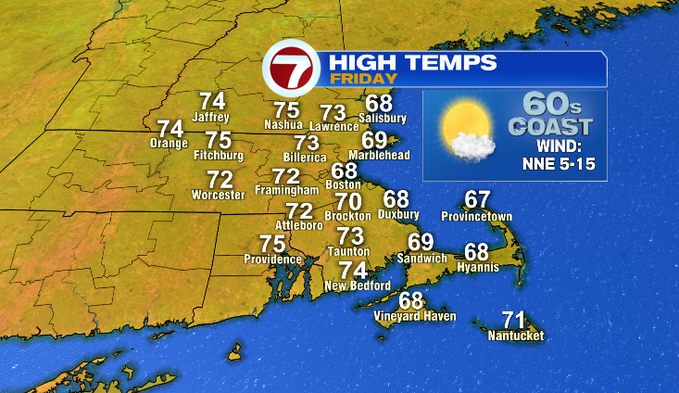
High temperatures tomorrow will be slightly below average. The coolest temperatures will be at the coast in the 60s. Mostly sunshine and comfortable air stick around too.
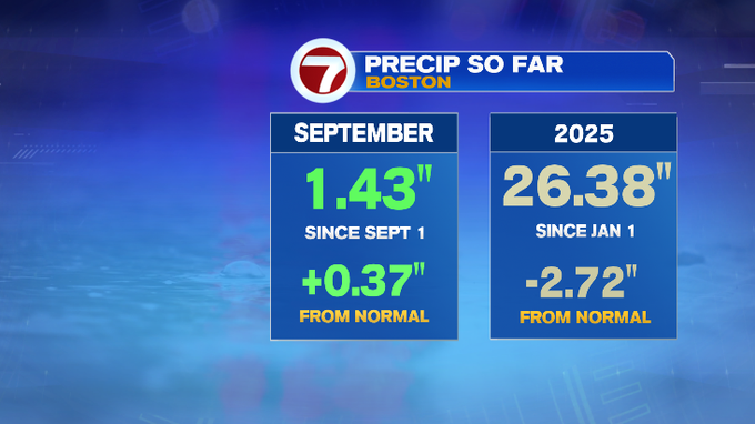
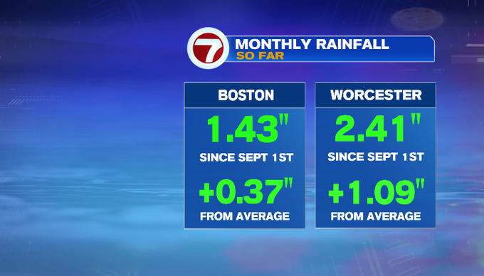
As we near mid-September, Boston is still slightly above normal for precipitation. This month so far we’ve picked up 1.43″, which is .37″ above normal. However, we’re in deficit compared to normal since January, 2.72″ below where we normally are for this time of year.
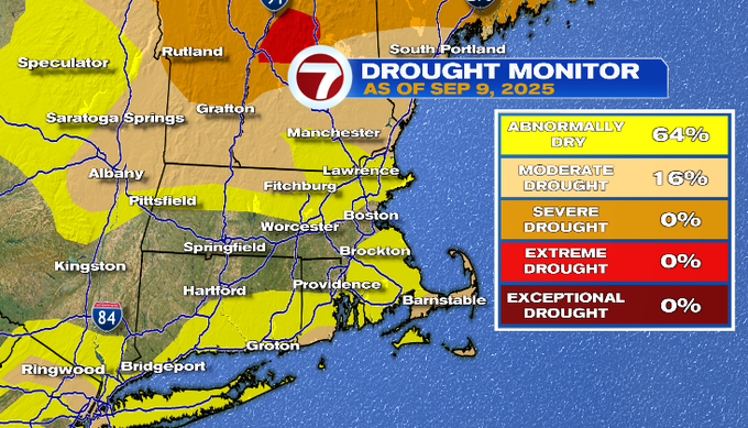
It’s elsewhere where we continue to be abnormally dry or are in moderate drought conditions like parts of northern Massachusetts and parts of the Cape. There hasn’t been much change from last week’s drought monitor. The updated drought monitor was released today. The numbers you see below are for Massachusetts. But spot the red. That’s extreme drought that has set in for about 7% of New Hampshire. That could pose some implications for leaf peeping this year.
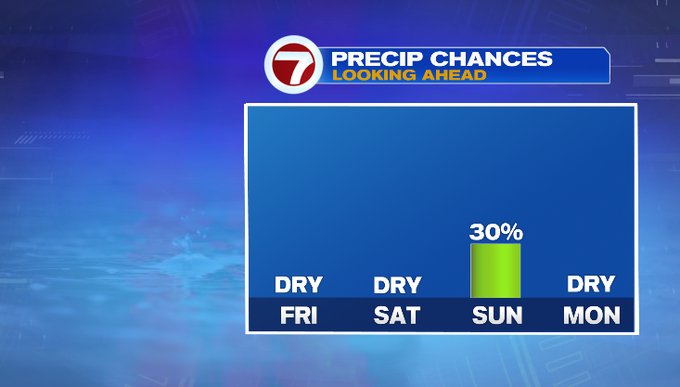
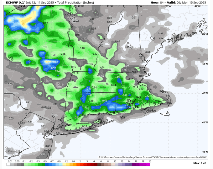
The chance for showers returns to the forecast on Sunday, although it won’t amount to a lot.
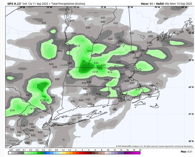
Here’s a look at estimated rainfall amounts through Sunday evening from the GFS and Euro models.
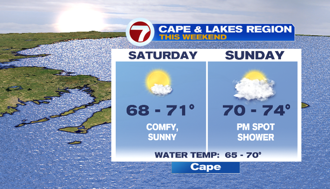
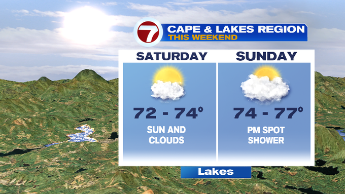
Here are some forecasts for events and places this weekend!

-MB
from Boston News, Weather, Sports | WHDH 7News
Source: https://ift.tt/Fp4MB8C
Comments
Post a Comment