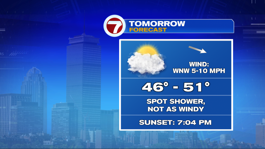
After morning sunshine, clouds took over for the afternoon today and those clouds will be with us tomorrow too. It’s not straight overcast all day long, but rather mostly cloudy skies for your Wednesday. Out of those clouds could be a spotty rain or snow shower, but they will be isolated — about a 30% shot. The Cape has the shower chance for most of the day, but for the rest of us, the shower chance will be confined to the afternoon and evening hours. It could be a passing rain shower, or even a few snowflakes closer to, and after sunset. Thankfully, the wind will back down from what we saw today.
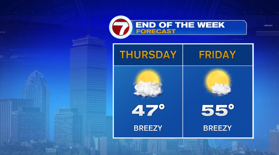
We’ll finish the week with more sunshine Thursday and Friday, and temperatures returning to the 50s by Friday. Both days will be on the breezy side, but enjoy that sunshine and dry weather because there are some big changes on the way for the weekend.
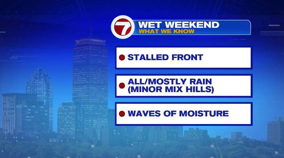
So here’s what we know about the weekend — and I’ll be honest, there’s a lot we don’t know about the weekend either and I’ll explain why. A stalled front will drape itself across southern New England for Saturday, Sunday and Monday, finally getting it’s act together and moving out of here late Monday and Tuesday. That front will send waves of moisture along it and put showers in our forecast all three days. Each day, it does appear like the precipitation will stay as rain in southern New England with perhaps some very minor mixing in the high terrain.
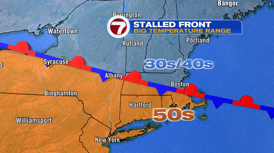
Here’s the hard part about the forecast. Literally a few miles difference where that stalled front sets up will mean drastic changes to the forecast. It’s not like a cold front moving through in the summer, where it arrives an hour or two early and drops our temperature by like 2°. We’re talking the potential of a 15-20° temperature difference on each side of this weekend’s front. But before we get to the temperatures, let’s talk about the precipitation.
The steadiest precipitation looks to be just to our north. And with the aforementioned temperature drop, that means rain, snow and sleet are possible across northern New England. The way it looks now, that mixed bag will be north of Manchester, New Hampshire. Not only will there be a mix of precipitation types, but that’s also where the precipitation will be steadier over the three days (Saturday, Sunday, and Monday). In southern New England, it will stay as rain with waves of it over the three day period. Meaning there will be dry hours but pin pointing those dry hours four, five and six days out is next to impossible at this point. And as you can imagine with the picture below, shifting where this front sets up by a few miles means big time changes to that precipitation map, especially if said front ends up farther south than it looks now and pulls the steadier (and colder) precipitation into southern New England.

As for the temperatures, the same can be true. With that stationary front set up for three days, we could feasibly have three days where Buzzard’s Bay sees temperatures in the mid to upper 50s, while the Merrimack Valley is stuck in the 30s. Much like the precipitation chances, a few miles of movement here means big changes to the temperature forecast this weekend. The moral of the story (or the forecast) is the weekend looks soggy, but how much rain, how steady, how heavy, and what kind (rain, sleet, or snow) has a higher than normal likelihood to change between now and the weekend. The same can be said for the temperatures as we get better data over the next few days and try to pinpoint where exactly that temperature boundary will set up shop.
from Boston News, Weather, Sports | WHDH 7News
Source: https://ift.tt/ak9liMK
Comments
Post a Comment