
We’ve got warmer weather on the way for the next few days, after what was a cold weekend and a cold start to the week Monday.
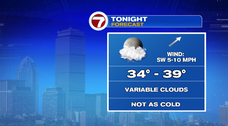
Morning temperatures Wednesday will be noticeably less cold in the mid to upper 30s. Afternoon highs will go way up into the mid 50s. Skies will be on the cloudier side, and we do have a chance for rain, too.

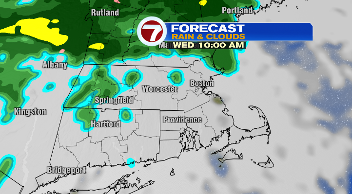
In the morning, there’s just a low-end chance for an isolated light rain shower.
Most of the widespread more moderate rainfall will hold off until the evening and nighttime.
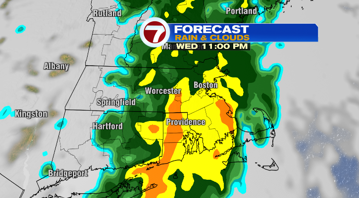
That’s when winds will pick up as well.

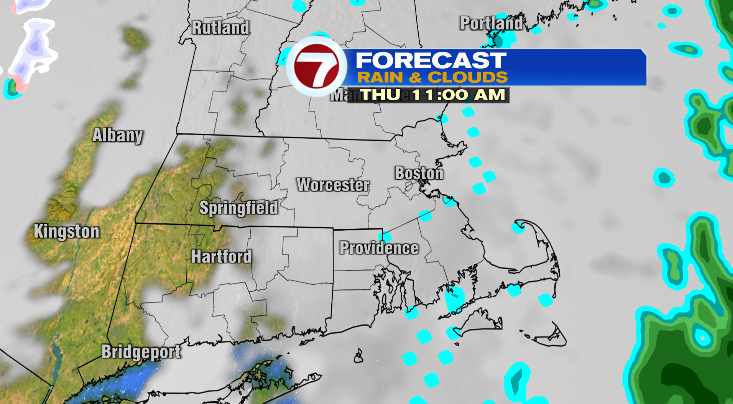
With rain overnight into Thursday morning, temperatures won’t budge much. Lows Thursday morning will only drop to the mid to upper 40s.
Thursday will be drier with cloudy skies. However, we still can’t rule out a spot shower, or some isolated sprinkles or drizzle. Highs will be even warmer in the upper 50s and winds will still be a bit breezy.
Friday will be a bit more seasonable. Highs will cool to the low to mid 40s under bright skies. However, a strong wind will make it feel like the 30s during the warmest part of the day. Saturday and Sunday both look partly sunny with highs in the low 40s and cold mornings. Don’t forget: clocks spring forward an hour at 2 a.m. Sunday morning.
Monday looks partly sunny with highs in the upper 30s and low 40s after a cold morning in the 20s. Tuesday: bright, 40s and windy.
Looking farther ahead, the middle of the month is expected to be dominated by unseasonable warmth.
from Boston News, Weather, Sports | WHDH 7News
Source: https://ift.tt/IlsQE60
Comments
Post a Comment