
While we hit the 50s Saturday afternoon across Massachusetts, a cold front rolling through will crash our temperatures overnight and through the next few days. However, there is light at the end of the tunnel!
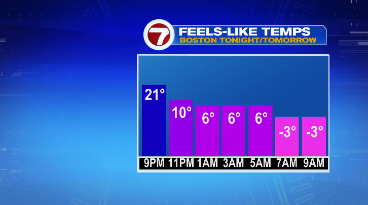
Overnight lows will get down to the single digits and the teens. Skies will become mostly clear, and the wind will continue to pick up. The wind will make it feel like it’s a few degrees below zero early Sunday morning.
Highs on Sunday will be downright cold. They’ll only reach the mid to upper 20s, but wind chills will still only top off in the teens.
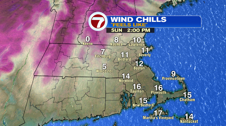
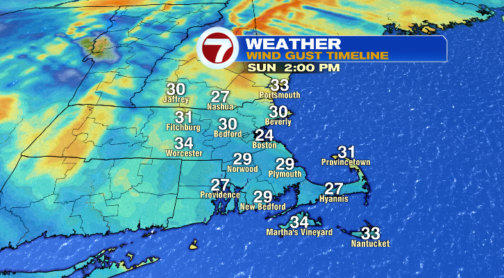
That’s due to wind gusts topping off near 30 mph throughout the day. At least skies will be sunny.
Highs on Monday will be a few degrees warmer in the upper 20s and low 30s, but morning temperatures will still be cold in the teens. Skies will be sunny again, but at least we lose the wind.
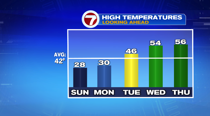
After Monday is when we start warming back up! Tuesday, highs will be in the mid to upper 40s after a cold morning in the teens. A few clouds will be around and winds will be breezy. Wednesday and Thursday will be the warmest days this week, but that comes with some rain.
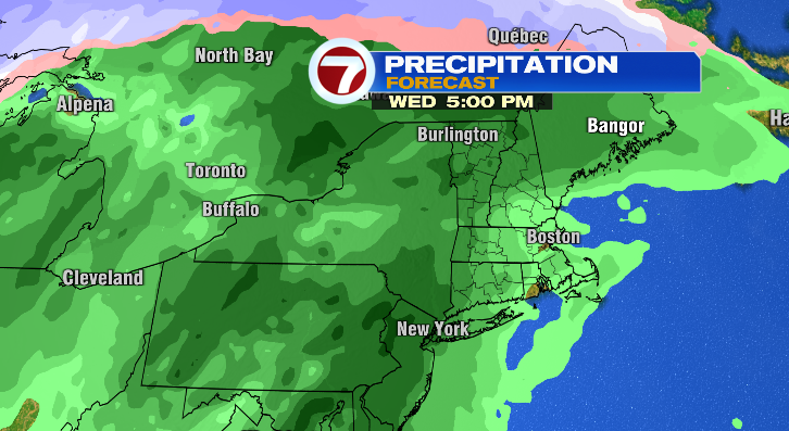
Wednesday will be in the 50s, but winds will be strong so make sure to get a raincoat for that rain. Thursday will also be in the 50s, the rain will be a little more spotty, and winds will be lighter yet still pretty breezy.
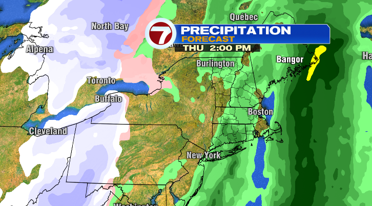
We dry back out Friday with mostly sunny skies, breezy winds and highs back down into the low to mid 40s. Next Saturday we’re watching for a chance of rain and snow. Stay tuned!
from Boston News, Weather, Sports | WHDH 7News
Source: https://ift.tt/C1RixTm
Comments
Post a Comment