
Get ready for an extremely busy next few days across Massachusetts! From snow tonight, to snow, ice and rain depending on where you are Sunday, to a windstorm Monday…we are in the middle of a very active weather pattern once again.
It’s already snowing out there, and the snow will continue to become more widespread and heavier overnight. Around midnight, it’ll still be plain snow for most.
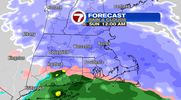
However, as a warm front advances overnight into Sunday morning, we are expecting changing precipitation types from the south to the north.
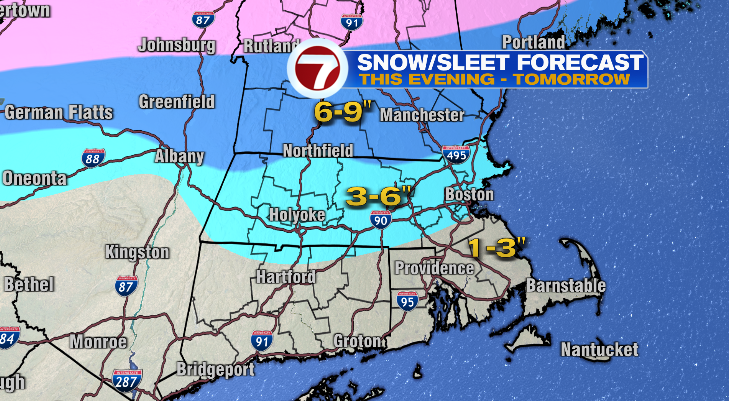
Before the precipitation changeover, most of us will see 3-6″ of snow with lesser amounts near the Cape and islands.
The Cape and islands will changeover to a mix first but by early Sunday morning should be just plain rain that’ll begin to wash away snow quickly. The wintry mix, sleet and freezing rain will linger the longest on Sunday for central and northern Massachusetts, southern Vermont and southern New Hampshire.
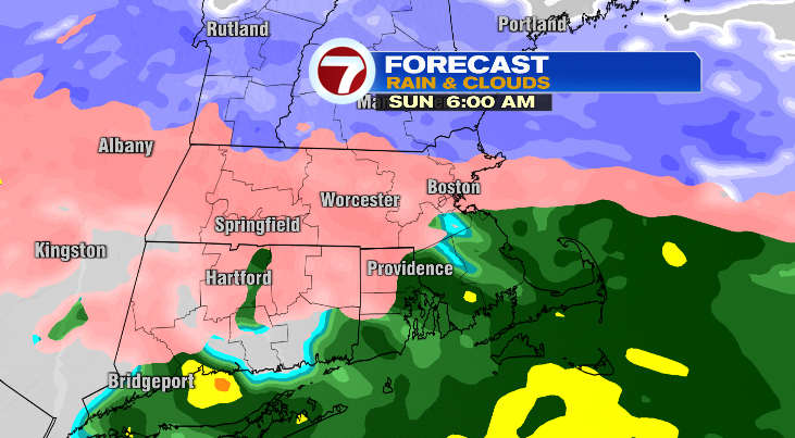
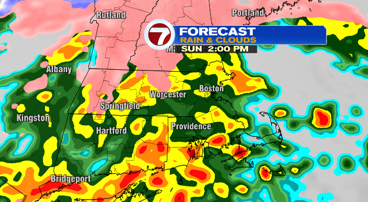
By 10 a.m., there won’t be much snow left but sleet and freezing rain well north and west of Boston with plain rain for those of you near Boston and south and east.
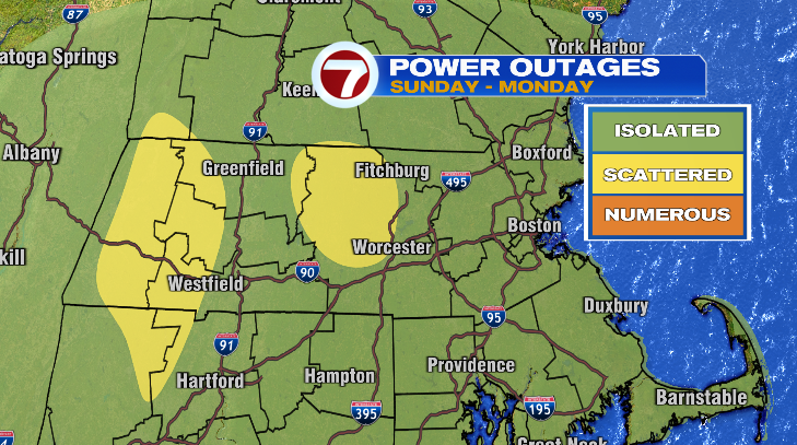
The ice will lead to slick spots on roads, but in central Massachusetts, the ice could also weigh down some trees, leading to a risk for some scattered power outages. Isolated power outages are still a possibility elsewhere.
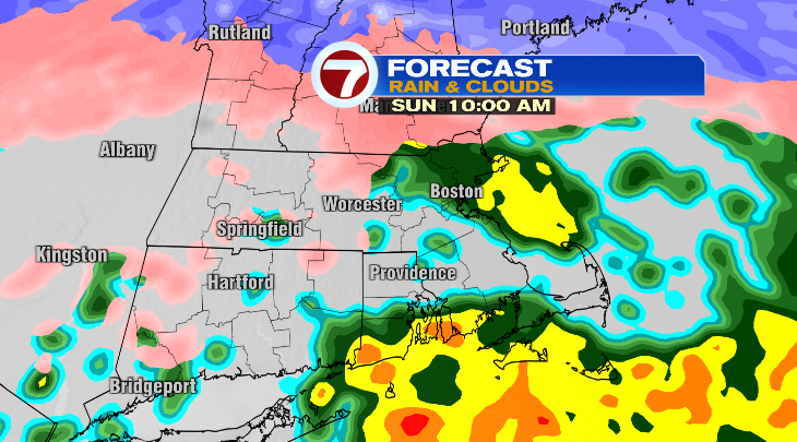
As we get later in the afternoon Sunday and temperatures continue to rise, more and more locations will switch to rain. The rain will be heavy at times, too. However, where you have the elevation, that sleet/freezing rain will linger even longer.
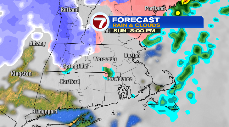
The precipitation will wind down Sunday evening becoming more and more hit-or-miss. Some locations in central Massachusetts may even briefly switch back over to snow.
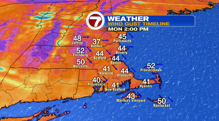
However, we aren’t done there…. after the snow, ice and rain comes the windstorm. Sunday evening it’ll already be incredibly windy on the Cape and islands with gusts over 40-50 mph. For most of us the wind will be bad on Monday. We have a widespread risk for 55-65 mph gusts.
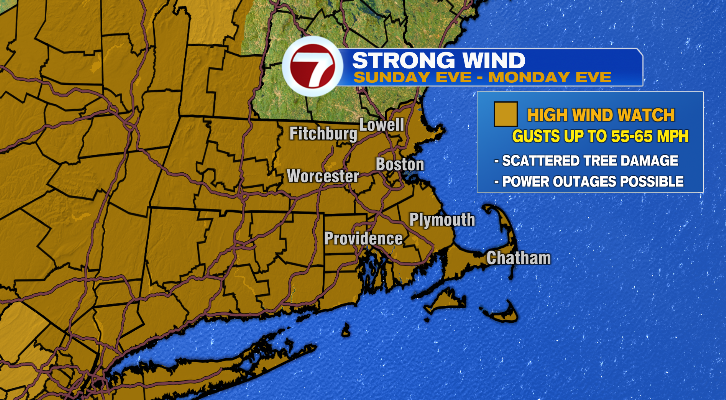
The problem with a wind like that is temperatures will stick to the 20s most of Monday. The wind brings a risk for more power outages, which would be problematic when temperatures are that cold and people have to potentially go without heat. The wind will be so strong feels-like temperatures will be in the single digits.
Monday is our first day of our next Arctic blast, too. We get even colder Tuesday through Thursday with morning lows in the single digits and teens and afternoon highs struggling to make it out of the 20s.
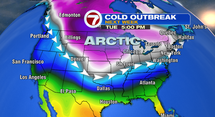
It’ll also be breezy during the next Arctic blast making it feel even colder. Our next storm to watch will be Thursday.
from Boston News, Weather, Sports | WHDH 7News
Source: https://ift.tt/LjIQrnO
Comments
Post a Comment