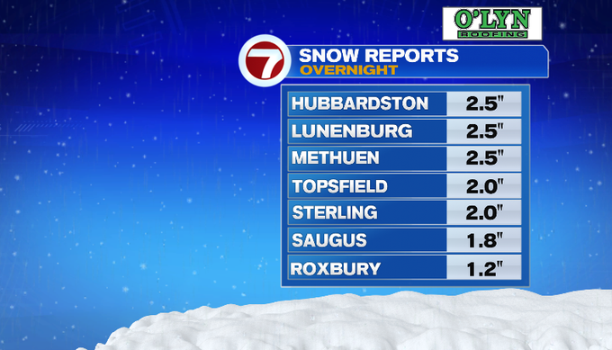
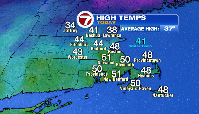
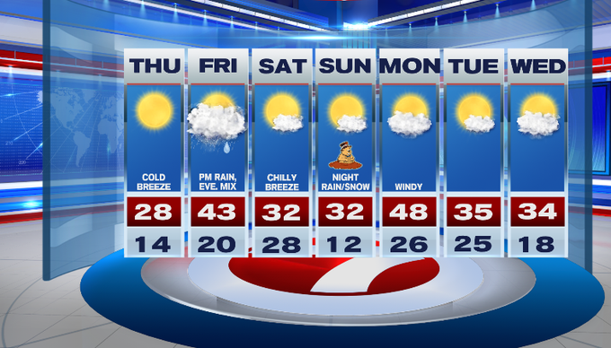
Our morning started off with some snow before a mild afternoon with high temperatures in the 40s. Some towns overachieved reaching the 50s! Get ready for weather whiplash. Our temperatures nosedive tonight and tomorrow, before rebounding to end the week.
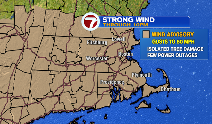
A cold front will continue moving east across southern New England. As the line of showers continues to slide across Massachusetts closer to the coast, expect spotty rain showers with temperatures so mild. Along with the front is gusty wind. Strong wind will be with us through this evening. There is still a wind advisory through 10 pm.
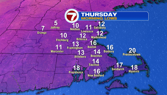
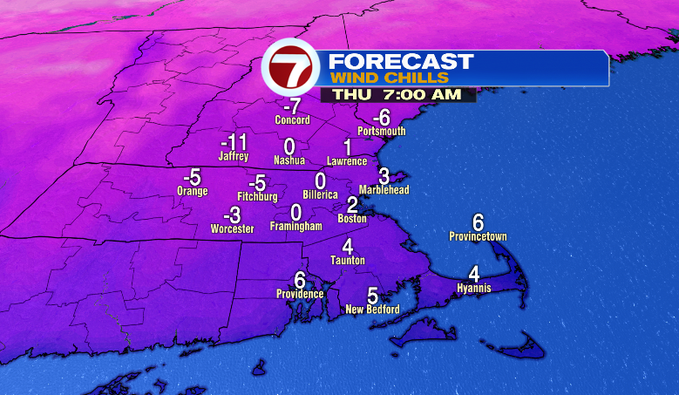
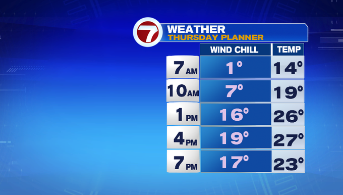
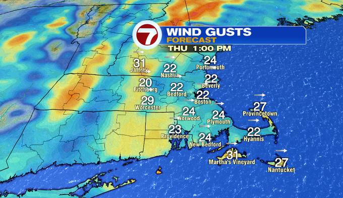
While the wind won’t be as strong overnight, it stays breezy. That will add an extra bite to the air tomorrow. Temperatures fall to the teens, but it will feel near 0° out the door tomorrow morning. Grab all your winter gear!
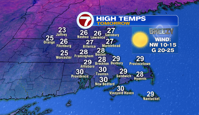
Tomorrow, we’ll see a lot of sunshine. It won’t help to warm us up. Temperatures stay in the 20s. A cold breeze will make it feel more like the teens.
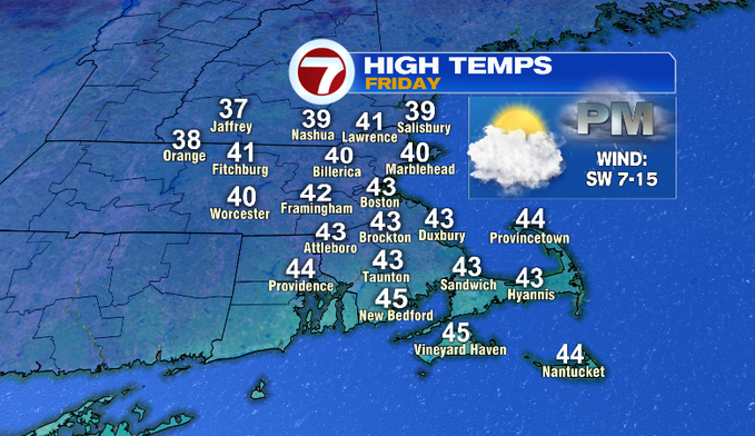
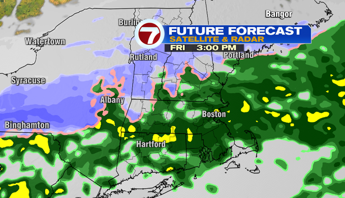
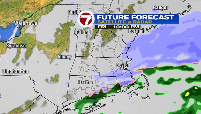
A warm front will return temperatures to the 40s Friday. Precipitation chances increase through the day. With temperatures being so mild, this will mainly be a rain event. Some snow showers will follow as the system moves out.
Saturday we’re dry but it stays cold. A northerly breeze will make it feel chillier.
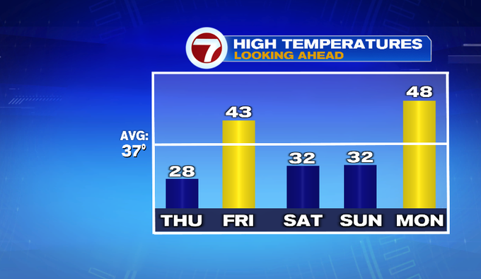
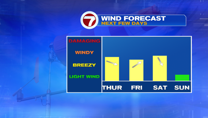
Less wind Sunday. It will be a frigid start and stay cold through the day. Our fairly active pattern continues with another chance for rain and snow Sunday night into Monday.
-Meteorologist Melanie Black
from Boston News, Weather, Sports | WHDH 7News
Source: https://ift.tt/NI32xZU
Comments
Post a Comment