We’re almost to the weekend… and our next storm. This weekend will bring a lot of cloud cover and temperatures won’t move all that much staying mainly in the 30s. Some drizzle tomorrow. Then Sunday morning, rain and snow arrives continuing into Monday.
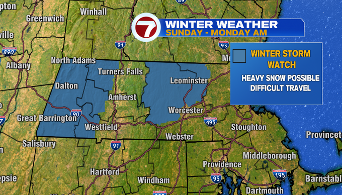
A Winter Storm Watch is up for Sunday through Monday morning where heavy snow is possible in northern Worcester and northern Middlesex counties and the eastern slopes of the Berkshires.
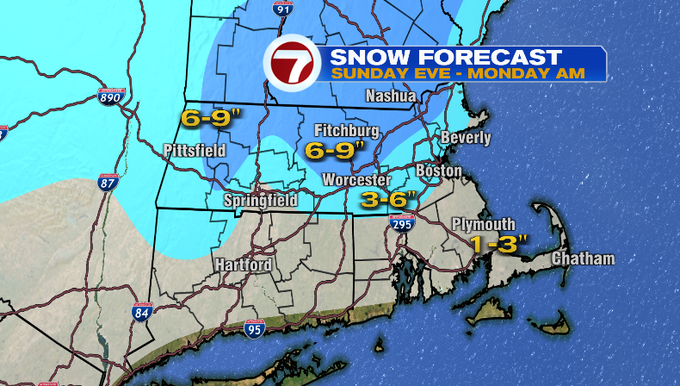
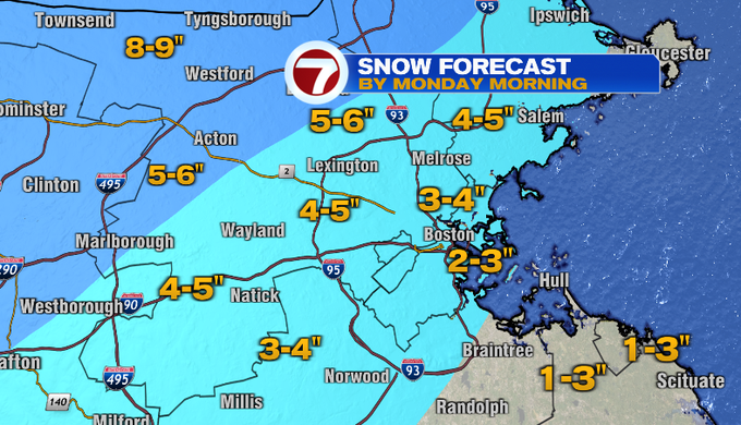
That’s also where the heaviest snowfall amounts will occur with this storm. Here’s a look at the snowfall accumulations Sunday evening through Monday morning.
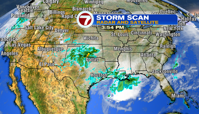
You can see the moisture for part of our storm across Texas and Louisiana this afternoon. An area of low pressure will develop and track inland, forming another area of low pressure near the coast. It’s that one that will bring us rain and snow.
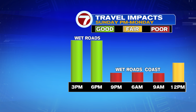
Here’s a closer look at the timing of the storm. This will be a snow event for areas north and west of 495, a mix for MetroWest and rain turning to snow at the end for Southeast Mass. Target early Sunday morning for the dry hours to be outside. It’ll still be chilly. Snow and rain arrives mid/late morning. The snow won’t accumulate until later in the day on Sunday. Late Sunday into Monday, the rain/snow line slips south, as the wind shifts and colder air above us starts to work in. This will end as snow showers for everyone Monday. Expect a slow Monday morning commute! It tapers to flurries later in the day.
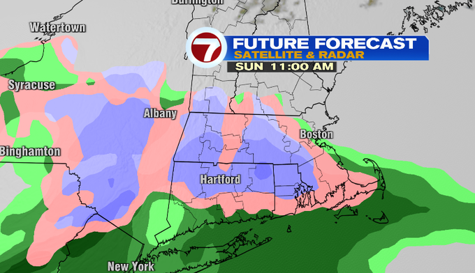
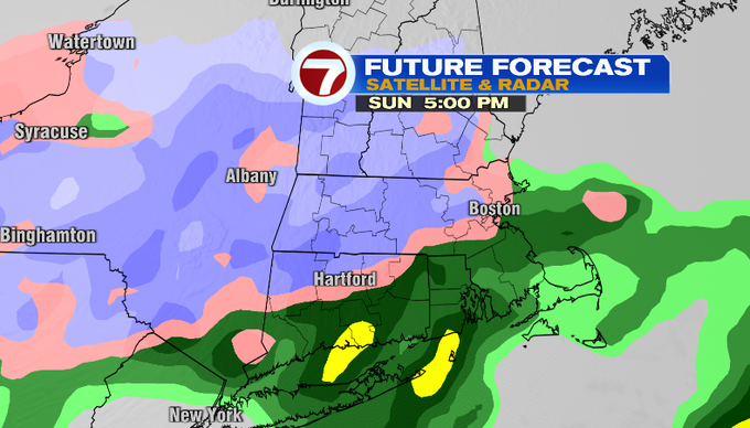
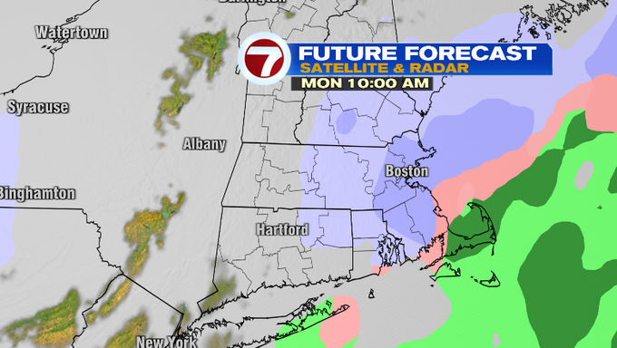
Here’s a closer look at the snowfall amounts for your town by Monday morning.
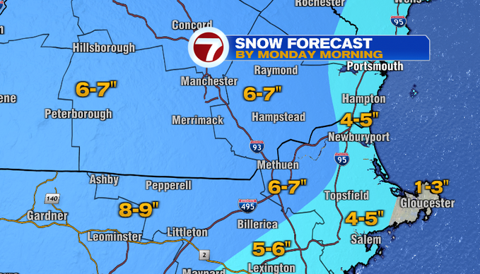
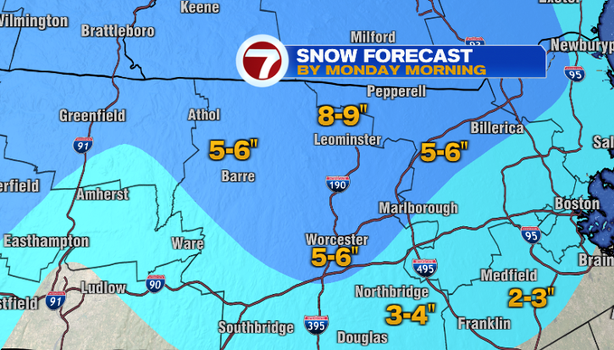
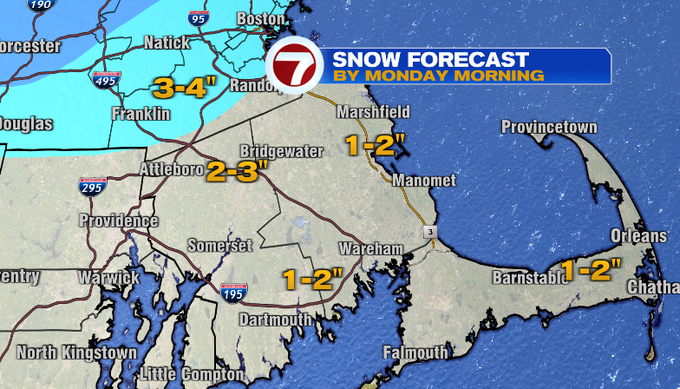
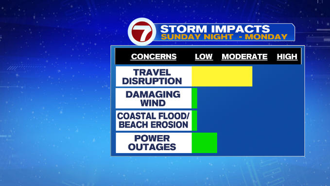
The storm will also kick up the wind. It’ll be breezy Sunday, and the wind peaks Monday. Gusts will be strongest on Cape Cod, Cape Ann and Nantucket. The heavy snow and wind gusts along and north of 495 into northern Worcester County and the Merrimack Valley could lead to a low risk for power outages. There isn’t a concern for coastal flooding with this storm.
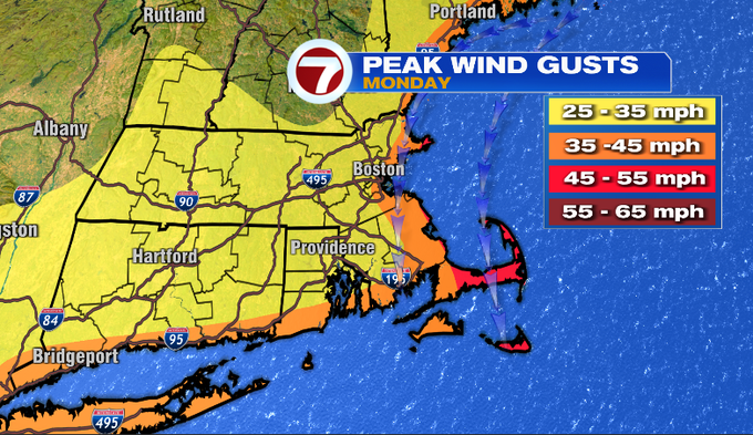
Temperatures stay cold Monday and Tuesday. We’ll get the sunshine back Tuesday! As of now, the rest of the 7-day forecast looks fairly quiet.
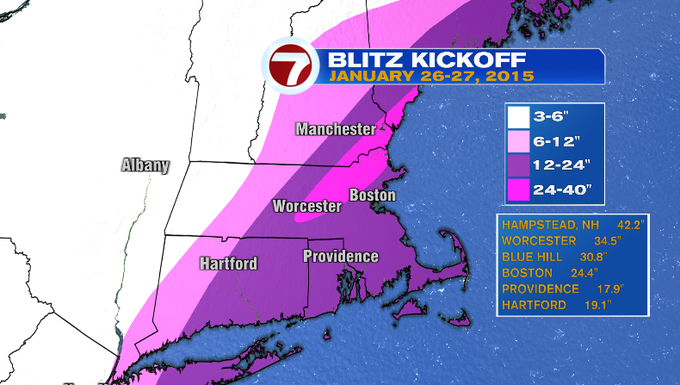
Before we wrap up this blog, let’s talk some weather history! Anyone remember what this date (January 26th) signifies? On this date in 2015, the first storm of the “Snow Blitz” arrived. This was the first of several storms to hit our region over a six-week period. Surprisingly, up until this point very little snow had fallen. Here’s a look at snowfall totals for the initial kickoff.
-Meteorologist Melanie Black
from Boston News, Weather, Sports | WHDH 7News
Source: https://ift.tt/RLmCOx6
Comments
Post a Comment