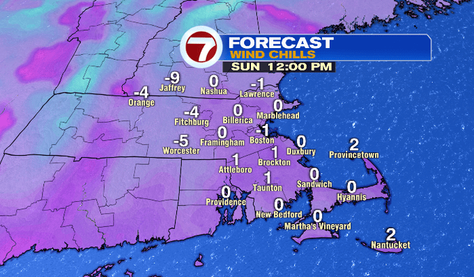
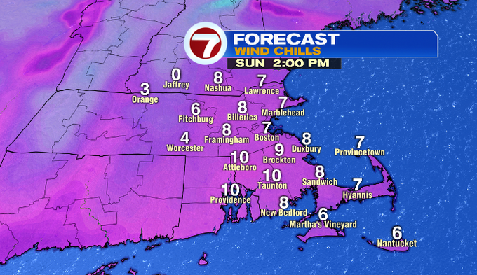
If you’re getting ready to head out to dig out after yesterday’s nor’easter, be sure to bundle up. Wind chills will be around 0° by noon, and remain in the single digits through the afternoon.
Speaking of yesterday’s powerhouse of a storm, southeastern MA and a few towns along the North Shore received 2 FEET or more of snow. The jackpot area looks to be Stoughton, Canton, and Sharon where over 30″ of snow fell.
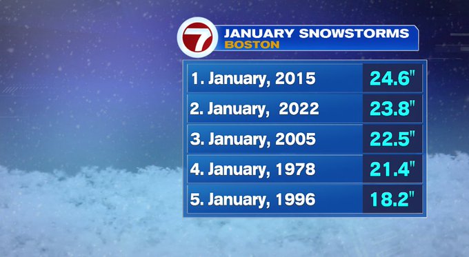
Boston was just shy of reaching the 2 foot mark, but as far as January snowstorms, it was the second highest January snowstorm on record.
Wind gusts were also damaging yesterday, especially at the coast where gusts varied from 60-80 mph.

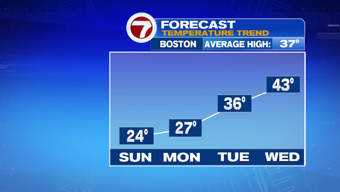
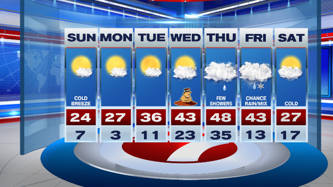
For the forecast for today, thankfully we do have the sunshine today. Highs will be in the 20s.
Tonight it will be another cold one with temperatures varying from 7-14°.
Tomorrow is another day with mostly sunny skies and highs into the upper 20s. We start a warming trend from Tuesday through Thursday.
We’ll keep an eye on Friday’s forecast through the week. Depending on the timing of a cold front to our northwest and precipitation associated with a system that will be approaching the region, we could see a mix of rain and snow, followed by much colder air for next Saturday.
from Boston News, Weather, Sports | WHDH 7News
Source: https://ift.tt/ljVXM6eWy
Comments
Post a Comment