Our next system is approaching the region, bringing rain and wind to southern New England for the first half of the holiday weekend.
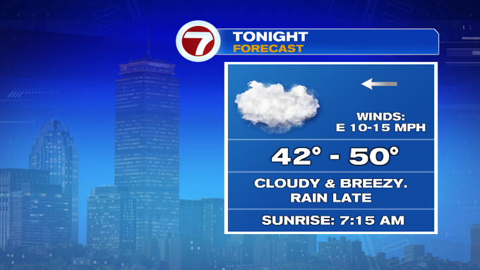
Tonight, the clouds will stick around with showers developing after midnight. Overnight lows will not be nearly as cold as last night (a few locations dipped below the freezing mark early Friday morning).
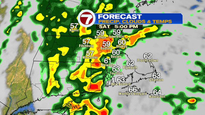
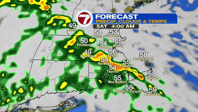
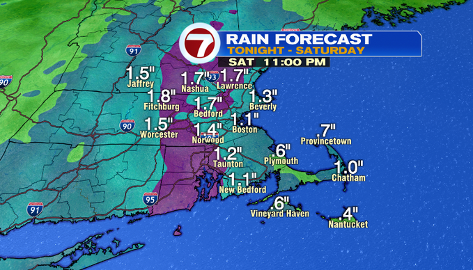
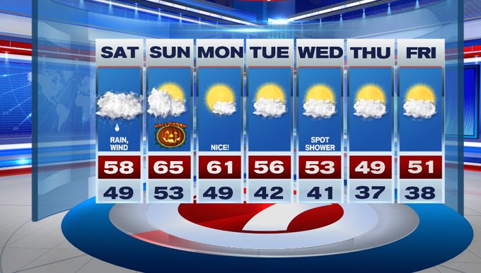
Saturday brings the shower, some heavy at times. Looks like we have a line of showers (with some embedded thunder possible) Saturday morning before daybreak and another line closer to dinner time. Between those two lines, the showers will be scattered.
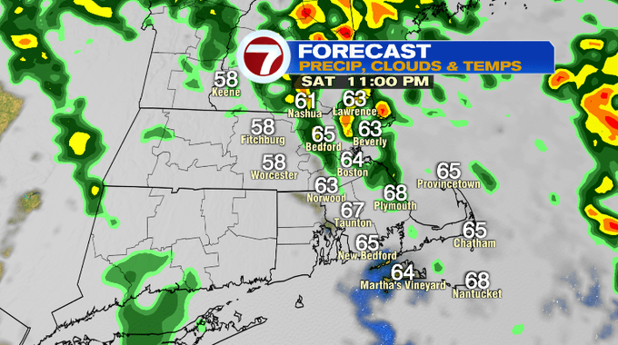
The rain lifts out Saturday night around 11pm. We’ll likely get around 1″ -1.5″ with a few places getting close to 2″ where the heaviest rain sets up.
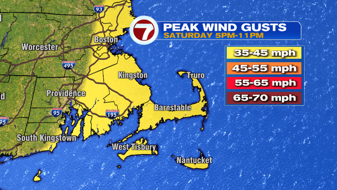
With this system, we’ll also have gusty winds, however these winds will not be nearly as strong as our fall nor’easter from a few days ago. Gusts could top out around 40 mph for the Cape and Islands and Cape Ann/Gloucester, around 35 for Boston, 25 mph farther inland. These peak gusts are slated to pick up around 5pm and could linger to 11pm.
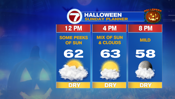
This system moves out just in time for the second half of the weekend. The winds shift to out of the southwest, allowing for warmer air to filter in, providing some warmth for Halloween 2021. Highs on Sunday will stretch into the mid-60s under a mix of sun and clouds.
For trick-or-treaters Sunday evening, temperatures slip back into the upper 50s, which is typically our average high for this time of year.
The 60s stick around as we kick off the next work week and the start of the month of November. However, it is short-lived as high temperatures dip back into the 50s midweek, 40s by Thursday.
from Boston News, Weather, Sports | WHDH 7News
Source: https://ift.tt/2ZzQQma
Comments
Post a Comment