Temperatures are going to drop quite a bit overnight, and they will a few times next week! This comes ahead of some new rain chances, too.
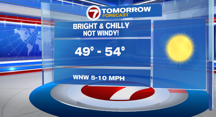
Under mostly clear skies, lows will drop to the upper 20s and low 30s overnight into early tomorrow morning. However, with less wind and bright, sunny skies, highs will rebound into the low 50s Sunday afternoon.
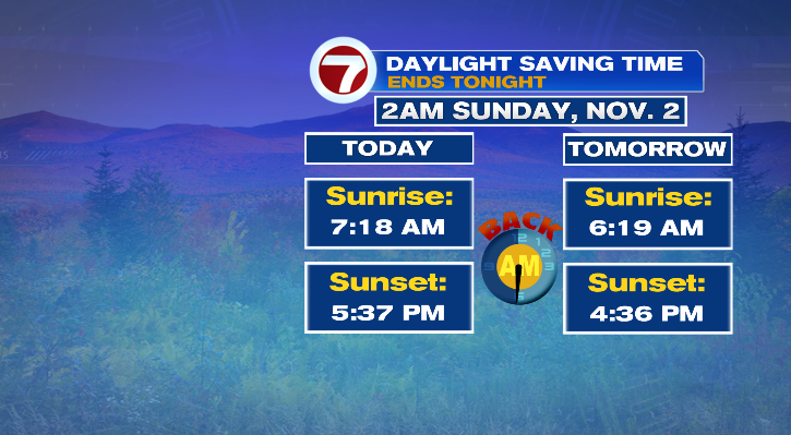
Don’t forget to set your clocks back an hour too!
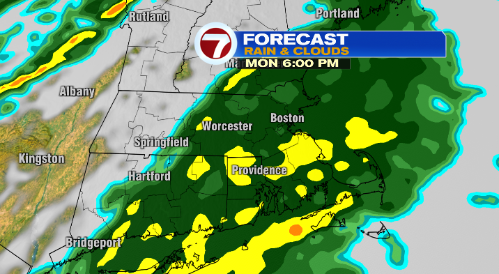
Monday morning starts in the low 30s, too, with afternoon highs in the upper 50s and low 60s. The day starts dry, but scattered showers roll in for the afternoon and widespread rain will be around for the evening commute. It will be light to moderate rainfall.
The rain will continue overnight, but it clears out before Tuesday morning. Tuesday morning will kick off in the low 40s with highs in the mid to upper 50s. Skies will be nice and bright, but the wind will return making it feel cooler than it really is.

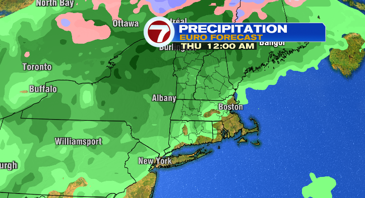
Wednesday morning’s lows will drop to the upper 30s with afternoon highs in the mid to upper 50s. It won’t be too windy, and skies will start off partly cloudy but will become mostly cloudy ahead of another round of rain Wednesday night.
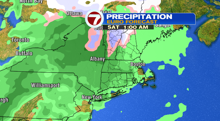
Thursday, there could be a lingering morning showers but otherwise will be partly sunny with highs in the low 50s. Not bad, but it will be windy again. Friday will feature increasing clouds with lows in the low 30s and highs in the mid 50s. More rain chances return again Friday night into Saturday morning.
from Boston News, Weather, Sports | WHDH 7News
Source: https://ift.tt/hOUKGry
Comments
Post a Comment